Before you decide how high to lift a house, you need to know how high it sits right now. That one number shapes almost every choice that comes after it. A flood elevation survey gives you that starting point in writing, based on real measurements instead of a guess.
Many homeowners skip this step and start with the finished height in mind. That order can cause problems down the line. The steadier place to begin is the ground you already have.
Start With the Home’s Current Elevation, Not the Height You Want
You can’t plan a good raise without knowing where the floor sits today. A height goal only makes sense once you have a fixed point to build from. Skip that step and every later number rests on shaky footing.
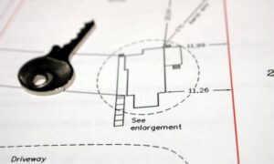
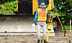
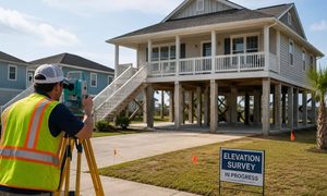
A flood elevation survey records the home’s existing elevations. A licensed surveyor measures the building and the land, then puts those figures on paper. This is measured data, not a read taken from how the house looks or how it lines up with the neighbors.
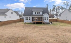
Guessing is where trouble starts. A home can sit higher or lower than it appears to the eye. Online maps and nearby houses often point you the wrong way, so site measurements settle the question.
Once you have real numbers for your existing home elevation, they can sit next to the flood rules for your area and the plans for your project. Everyone works from the same facts. That shared baseline keeps the whole house elevation project on solid ground.
Compare What You Have With the Project’s Target Elevations
The next move is to line up your surveyed elevations with the flood elevation information that applies to the site. This tells you how far the house may need to travel. It also shows where you stand before any design work locks in.
One rule matters more than people expect. Both numbers have to use the same vertical datum, which is just the shared reference point that all the elevations are measured from. Louisiana DOTD notes that elevations on an Elevation Certificate must use the same datum the Base Flood Elevation is based on, and any conversion has to be shown when the field survey uses a different datum. Mix two datums by accident and the whole comparison falls apart.
The Base Flood Elevation, or BFE, is the flood height many projects use as their target. You don’t have to memorize every term. You just need your survey and your flood figures to speak the same language.
Homeowners sometimes miss one point. The survey does not set your final required height on its own. That answer can depend on local floodplain rules, the project itself and the standards that apply. The survey supplies the measurements. The rules decide the target.
The Elevations a Raising Project May Need
This is where a flood elevation survey earns its place. Depending on the project and the rules that apply, a surveyor may capture several kinds of measurements:
- The existing lowest floor elevation
- Ground elevations around the structure
- Building elevations needed for the design or certification
- Reference points the surveyor uses to tie everything together
- How the house sits in relation to the land around it
Not every project needs all of these. Some need only a few. The right list depends on your home, your site and what the applicable rules call for.
FEMA’s current Elevation Certificate instructions treat building elevation information as a survey-related item in flood zones where it applies. When certification is required, a properly authorized professional has to sign that work. So the person taking these measurements matters as much as the measurements themselves.
Put the Survey to Work Before the Lift
The physical raise is a construction job. The survey does its main work before any of that starts. It sets the stage so the crew isn’t guessing on the day the house comes off its foundation.
Good elevation data helps the team make clear choices early. It creates a record of existing conditions everyone can trust. The engineer, architect, contractor and floodplain official all plan from the same baseline, which cuts down on crossed wires. You can also check whether your planned height lines up with what the project calls for.
Documented elevations feed the permit and certification steps that may apply. Solid numbers up front mean fewer surprises once work begins. That kind of certainty is hard to buy back later.
FEMA’s guidance on elevating homes ties the amount of lift to the flood protection height chosen for the project and the rules that apply. A survey helps you see that gap early. It won’t replace engineering, permitting or floodplain review. Treat it as one input the rest of the project leans on, not a stand-in for the professionals who guide the raise.
Why Home-Raising Projects Need Site-Specific Information
Flood conditions don’t look the same from one place to the next. Terrain, water and flood risk shift across the state and sometimes within a single block. A figure that fits a general area may not fit your exact structure.
That’s why current, site-specific measurements carry so much weight when you’re raising a house in a flood zone here. Your home’s real elevations, taken on your own lot, give far more reliable numbers than broad estimates ever could. General data can point you in a direction, but it can’t measure your foundation for you.
Louisiana DOTD offers statewide flood-mapping resources and points out that more than one source of flood information can exist for a location. The right source depends on the type and detail of the study behind it. A local floodplain authority can help you sort out which information applies to your property.
So talk early with that authority and with the professionals on your project. Read your survey data against the rules that govern your specific site, not a general assumption. The two together give you a fuller answer than either one alone.
A flood elevation survey gives a home-raising project a reliable measurement baseline. The final height, though, should come from the floodplain, design and permit requirements that apply to your property. Get the baseline right first, then let those requirements set the mark.